
Page content
Basic Information
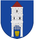
The Šumava town of Hartmanice (German name Hartmanitz) is located 11 km southwest of Sušice and 32 km southeast of the district town of Klatovy. During the reign of John of Luxembourg, Hartmanice was promoted to an "upper town" in 1320 due to gold mining. In 1607 Rudolf II granted Hartmanice a coat of arms, the right to seal official matters with green wax and the right to hold a weekly market on Fridays and a fair twice a year.
| Population | 929 (to 1. 1. 2022) |
| Area: | 62,2 km² |
| Altitude: | 712 m the highest point of the administrative area of the municipality - Mount Křemelná 1125 m the lowest place – 550 m |
| Number of local parts: | 23 |
Části obce
A village 2.5 km north of Hartmanice on the road Hartmanice - Petrovice u Sušice.
The settlement lies 2.5 km south of Hartmanice. Formerly a place of pilgrimage, later the seat of the military training area of the same name, today an important tourist destination.
A village 2 km east of Hartmanice near the Otava River.
A village 3 km northwest of Hartmanice, the second largest settlement in the municipality.
Hartmanice is located in Šumava, in the district of Klatovy, about 11 km southwest of Sušice and 32 km southeast of the district town.
A village 1 km north of Hartmanice.
The village is 3 km northwest of Hartmanice.
A remote village 6 km northwest of Hartmanice below the Vosík hill.
The settlement was part of a military training area until 1992, 10 km west of Hartmanice. Keply is located in the cadastral territory of Kochánov III.
Scattered remote settlement 11 km west of Hartmanice on the road Keply - Petrovice u Sušice.
Solitude 3 km south of Hartmanice, without permanent inhabitants.
The most populated settlement of Hartmanice, 1 km south of the village.
Village and yard 3 km north of Hartmanice.
Secluded 4.5 km southeast of Hartmanice on the trail to Rejštejn and Kašperské Hory.
The village is 6 km northwest of Hartmanice.
The village is 3.5 km east of Hartmanice.
A village 2.5 km north of Hartmanice, 0.7 km above Dolejší Krušec.
A village 2 km southeast of Hartmanice on the road to Rejštejn.
A village 3.5 km north of Hartmanice on the road Hartmanice - Petrovice u Sušice.
The village is 1 km east of Hartmanice.
Village 3,5 east of Hartmanice.
The village is 5 km northwest of Hartmanice.
The village is 2.5 km southeast of Hartmanice.
Partnerské obce
Rinchnach (Německo)

Affoltern im Emmenta (Švýcarsko)